

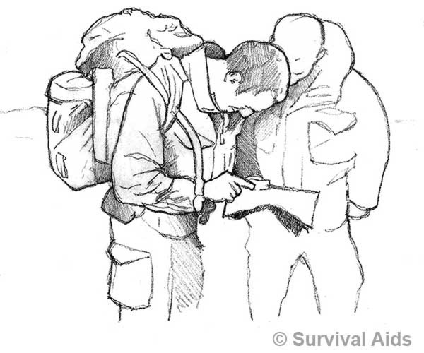
Map reading is an interesting, useful skill to possess as a civilian, it can broaden your horizons and give you safe access to the countryside. Maps reach back through our nation's history and have always been important. As a soldier proficiency at map reading and navigation is absolutely essential, military units place great emphasis on it during training. It's Pass or Fail. You can learn it yourself and then further your skills by getting out on the hills for the weekend or taking part in orienteering which is a fun, competitive activity.
Fear of failure in front of others means that some soldiers are "backwards in coming forward", being the Lead Scout of a patrol of ten blokes who are all relying on you to navigate them back to the base so they can snatch a few precious hours kip, is pressure. However, practice makes perfect and you'll get a real sense of accomplishment when you get it done well. A good, reliable, steady map reader is a prized asset to any commander, and will only advance your prospects.
With practice and dedication, your map reading skills will be as sharp as your Fieldcraft and SAA. In addition to being able to navigate, locate your position if you get lost and tell how long a leg will take, skilled map readers can study the map and visualise the ground in their "minds-eye". This is the real prize, they will swiftly be able to make an assessment of the best route for the patrol.
CARE OF MAPS
In the British Isles, maps are produced by the Ordnance Survey, military maps are produced by the RLC's Mapping Dept and can be tailored to suit a particular requirement. Maps should be protected, they are made of paper, and won't survive repeated soakings, place them in a map case, there are many types of waterproof map cases available.
RELIABILITY OF MAPS
A map is a 'birds-eye view' of the ground and is accurate only at the time it is drawn. Modern mapping is produced by satellite technology and aerial photography, but as time goes by the ‘picture’ on the ground changes, villages expand, new roads are laid, woods are cut down and others planted etc... For everyday map reading purposes, this will not affect the accuracy too much, but it should be borne in mind. In a nutshell if the map you've been issued is 25 years old, it will be considerably less accurate than one printed this morning.
MARGINAL INFORMATION
Maps should include 'marginal information' this provides guidance on how to read the map and how to interpret the detail, refer to this until you have a complete understanding of what all the symbols (usually called Conventional Signs) and other information mean, but do not be tempted to cut them off to save weight/space. The number of your map and its scale will be found at the top of the map. The index to adjoining sheets is shown as a diagram near the bottom right-hand corner of the map. You will need to find out which sheet number you require to cover the particular area that you are using and the next sheet if your route goes "off the map". Most maps now use metres as the "unit of elevation", check your map by looking in the margin at the bottom of the map as "ELEVATIONS IN METRES".
THE GRID SYSTEM
The British National Grid System divides the whole country into 100 km sq squares, these squares are further subdivided by GRID LINES printed on the map. GRID LINES are the way you 'pinpoint' a specific spot on your map.
Maps are printed with the North at the top of the sheet, one set of GRID LINES run up and down the map (North and South), the others run across the map (East and West). It is important that you are able to find a point on the map and then be able to go out and find it on the ground, also to be able - at all times - to indicate on the map the exact place where you are standing on the ground.
To assist in the accurate use of the grid system it is advisable to obtain a Pathfinder Protractor/Romer, it provides two of the different scales of GRID SQUARES found on Ordnance Survey Maps. This Romer is made of rigid plastic which you place on the GRID SQUARE of the map and read off the figures as described below, to pinpoint the exact position.
FOUR AND SIX FIGURE REFERENCES
When giving a reference there are a few simple rules to remember:
1. FIRST - count the figures along the BOTTOM of the map, from left (west) to right (east) these are called 'EASTINGS'. Next count the figures up the sides of the map, from bottom (south), to top (north) these are called 'NORTHINGS'.
2. A reference must always contain an even number of figures
3. GRID REFERENCES are always given with the 'EASTINGS' value first, followed by the 'NORTHINGS' value.
The example in the diagram below shows a black square, that can be given the reference as square 8040 (a four figure reference). This square could represent a whole square kilometre of ground, not exactly a 'pinpoint' location on a map or ground.
 Should you use a four-figure reference, you must add a feature to indicate where you mean. To get an exact position, the square is further subdivided into 10 squares in both directions.
The diagram below illustrates this subdivision, the black square is "square 7 - 7, these figures when added as explained below make up a six-figure reference The first two figures the EASTING value, followed by the subdivided square figure, then the two NORTHING value figures, followed again by the subdivided figure, making up a six figure reference 807407.

ALWAYS ORIENTATE YOUR MAP FIRST
SETTING A MAP WITH (SILVA) TYPE COMPASS
The first essential drill on the ground with a map is to 'set it' or sometimes know as 'orientating' your map. Until you do this it is difficult to establish your exact position on the map/ground. Carry out the following:

1. Lay your map out flat, find the MAGNETIC NORTH ARROW - usually in the margin of the map as shown at 'A' on the diagram opposite.
2. Lay the base of your Silva Compass on the map with the DIRECTION TRAVEL ARROW (B) in line with the MAGNETIC NORTH (see diagram 'line-up')
3. Carefully turn the map and compass around - watching the compass needle swinging, until the RED MAGNETIC END of the COMPASS NEEDLE (C) coincides with the DIRECTION OF TRAVEL ARROW (B) and the MAGNETIC NORTH ARROW (A) on the map.
Your map is now set or orientated, in relation to the ground.
SETTING A MAP WITHOUT A COMPASS BY OBSERVATION
This can be easy, once you have identified exactly where you are on the map, and if you are standing on a straight road, line up the road on your map with the road you are standing on.
Make certain that the map is pointing in the right direction, i.e. the right way round.
If not on a road, you will need to find other objects on the ground such as a road/track junction, church, prominent hilltop or farm buildings. You must also find and identify the same objects on your map, using them as shown in the diagram below by turning your map to set or orientate it in relation to the ground. North, East, South and West are known as the cardinal points of the compass.

THE LIGHTWEIGHT (SILVA TYPE) COMPASS

CARDINAL POINTS OF THE COMPASS
There are 32 points of the compass, but only 16 of them are normally used in map reading for the description of direction. These 16 are the four cardinal points and 12 intermediate points as shown in the diagram on the next page.
The letters N, S, E and W stand respectively for NORTH, SOUTH, EAST and WEST. In the intermediate points these letters are combined, e.g. SE is South East. NNW is North North West, etc.
These points describe direction only to within one sixteenth of the full circle: for more accurate indication of direction it is necessary to use subdivisions of the circle using "mils" or "degrees". The mils system is used by the Army to give much greater accuracy than degrees.

The MILS SYSTEM divides the circle of the compass into 6400 MILS, the zero being at the North Point. The four quadrants or quarters of the circle are each 1600 mils, and so the East, South, and West points fall at 1600, 3200, 4800 mils respectively, as illustrated. The symbol normally used to represent mils is the character letter m, with a / across it, and appears as m.
NORTH POINTS
There are THREE NORTH points:
1. TRUE NORTH - The actual direction of the geographical North Pole..
2. GRID NORTH - The direction of the vertical GRID LINES on a map. For all practical purposes TRUE and GRID NORTH are the same.
3200
3. MAGNETIC NORTH - The direction towards which the compass needle is attracted is the MAGNETIC NORTH POLE, (MN) see the diagram on the right.

ANGLES BETWEEN NORTH POINTS
Grid Magnetic Angle. (GMA) This is sometimes called the magnetic variation and is the angle between GRID NORTH and MAGNETIC NORTH it depends on two factors:
1. TIME. As the position of the Magnetic North Pole moves slightly eastwards, so the GMA (Grid Magnetic Angle) changes. This is called the Annual Magnetic Change and must be taken into account when converting magnetic bearings to Grid Bearings and vice versa.
2. PLACE. The GMA (Grid Magnetic Angle) also varies from one part of the country to another. These two factors are included in the marginal information on the map.
MAGNETIC DECLINATION
This is the angle between MAGNETIC and TRUE NORTH as shown on the diagram.
GRID CONVERGENCE
This is the angle between GRID NORTH and TRUE NORTH which can, in practice, be ignored since for practical map reading purposes TRUE NORTH and GRID NORTH are the same.
BEARINGS - TYPES OF BEARINGS
As there are three types of North points, there are three kinds of bearings, according to the North point from which they have been measured:
1. A MAGNETIC BEARING is one taken with a compass (an accurate compass needle always points towards MAGNETIC NORTH).
2. A GRID BEARING is one measured on a map with the Silva compass used as a protractor or using your Pathfinder Protractor/Romer.
3. A TRUE BEARING cannot be measured directly but must be calculated from the other two. However, this can be ignored for practical map reading purposes.
NOTE. INDIVIDUAL COMPASS ERROR (ICE) The accuracy of each individual compass is subject to error, it is important that you should check your own compass to establish the INDIVIDUAL COMPASS ERROR (ICE), do this by checking it against other compasses. Having done so make a note of it on your compass base with a small sticky label, don't forget to allow for it.
TO TAKE A MAGNETIC BEARING
1. Point the compass direction of march arrow at the object.
2. Turn compass housing until the red arrow is under the needle.
3. Read off the MAGNETIC BEARING on the compass housing One of the most common uses of taking bearings is to take one from the map to find the bearing to march on with your SILVA type lightweight compass or your protractor which is quite simple.

TO TAKE A GRID BEARING
NOTE: IGNORE THE COMPASS NEEDLE.
a. Place the long edge of the compass along the desired line of travel, making sure that the DIRECTION OF TRAVEL ARROW (1) on the compass POINTS IN THE DIRECTION of your LINE OF TRAVEL (2)
b. Turn the COMPASS NEEDLE HOUSING (3), so that NORTH on the housing rim points to NORTH on the map.
You will notice that the MERIDIAN LINES (4) on the COMPASS are parallel to the GRID LINES (5) on the map - or they should be.
c. Read the number of mils/degrees against the DIRECTION OF TRAVEL LINE at (6), this is the GRID BEARING. Having taken a GRID BEARING from the map, you must take into account and make allowances for the GRID MAGNETIC ANGLE (GMA)

FINDING YOUR POSITION WITH A COMPASS - RESECTION
There may be times when you need to find your exact position both on the map and on the ground. This could be as a result of being "dropped-off" on an exercise or if you were unfortunate enough to crash land in wild country. You could find your position by using a compass and following the instructions set out below. You will need to refer to the diagram on this page.

1. Set/orientate your map. Select TWO prominent objects or features which you can be sure of identifying on the map. These objects/features need to be a good distance away, more than 1000 metres and also be separated by an angle of approximately 10 o'clock to 2 o'clock - see diagram on next page.
2. On the "plastic" cover of your map, mark the objects/feature at "A" and "B". From the position at which you are standing, (call it "C") take a bearing on to each of the objects/features in turn, writing down the bearings. As this has to be accurate, don't move from your position and take a further two bearings on both of the objects/features. Add together the three bearings to each object/feature and divide by three to get the average bearing to each.
3. These are COMPASS Bearings, they are MAGNETIC Bearings. As you are to use them to 'plot on a map', they have to be converted from MAGNETIC to GRID Bearings. NOTE: You will always be best advised to draw a small diagram - until you become familiar with working with bearings - showing the NORTH POINTS as shown on page 8-8, this will remind you to make an allowance for the GMA (Grid Magnetic Angle).
The current GMA is approximately 50 mils (30 ) This is the figure that you would subtract from the MAGNETIC BEARING.
REMEMBER: "MAG TO GRID - GET RID"
4. Check the resulting bearing and adjust it to the nearest 25 mils. Remember the settings or divisions on the compass card of a Silva or Light Weight Compass are 25 mils.
5. Now set up the GRID BEARING on your compass for bearing "A". Use a wax pencil with a fine point , put the point on "A" . Hold it in a vertical position, place the long edge of the compass against the pencil with the DIRECTION OF TRAVEL ARROW pointing in the direction of "A", and the NORTH ARROW pointing approximately to the top of the map.
6. Using the pencil still in a vertical position, pivot the compass about the pencil point until the NORTH ARROW points exactly towards the top of the map, with the edge of the compass or any of the red setting lines on the compass base parallel to the nearest GRID LINES on the map.
7. Hold the compass firmly in this position while you draw a line along the side of the compass.
Repeat the same procedure from point "B".
Where the two lines you have drawn from "A" and "B" cross each other is your calculated position on the map/ground. Now work out your exact six figure GRID reference of your location.
CONVERTING A GRID BEARING TO A MAGNETIC BEARING

Remember all bearings are measured in a clockwise direction from the NORTH point. A MAG bearing will always be GREATER than the GRID bearing taken, by the amount of the GRID MAGNETIC ANGLE.
Therefore to convert GRID to MAG ADD the GRID MAGNETIC ANGLE (GMA) To convert a MAG bearing to a GRID, SUBTRACT the GRID MAGNETIC ANGLE.
GRID MAGNETIC ANGLE
(GMA) in the UK is as follows: GMA = 2.0 55" or 33.5 mils West in July 2012* (*approx.) *GMA changes yearly and you can get an accurate GMA reading from: http://www.geomag.bgs. ac.uk/data_service/models_ compass/gma_calc.html
REMEMBER "Grid to Mag - ADD" "Mag to Grid get RID"

IDENTIFYING A FEATURE
Set your map, use the edge of your protractor or a pencil, place it on the map with the edge running through your position, swing it across the map until it lines up with the feature on the ground. The feature should be easy to pick out, provided it is not too far away and that it is on your map!
After a while you will be able to locate and identify features by just looking across the map.

In setting your map, no matter what method you use, it is the constant relating and comparison of the map and ground which will build a good foundation for your navigational skills. We remind you that this skill above all will go a long way to prevent you from getting lost.

Practice, Practice Practice, then mapreading will be a natural skill
MARCHING ON A BEARING
Having converted your GRID BEARING to a MAGNETIC BEARING, set the graduated circle to read the MAGNETIC BEARING at the DIRECTION OF TRAVEL line.

Then turn the whole compass until the NORTH end of the NEEDLE coincides with the NORTH ARROW and is parallel to the MERIDIAN LINES on the COMPASS HOUSING, holding the compass in front of you, march in the direction indicated by the LINE OF TRAVEL ARROW.
So long as the compass needle and the NORTH ARROW are kept together, the DIRECTION OF TRAVEL ARROW will remain on the required bearing.
BACK BEARINGS WITH A SILVA COMPASS
When marching on a bearing - especially at night - over some distance you may often have a doubt in your mind that you may go wandering off course and finish up being lost. The ability to use your compass and to trust it by taking a back bearing on to the point from which you started, will prevent you from getting into difficulties.
The simplicity of the Silva compass makes the use of back bearings an easy navigational aid. To use the compass for a BACK BEARING, keep the compass on the bearing you have taken (as 'X' to 'Y' in the diagram), rotate the COMPASS HOUSING through 3200 mils(180º).
The compass is now set to march on the BACK BEARING (in the direction of 'Y' in the diagram) of your original FORWARD BEARING.
To retrace your route - (from 'Y' to 'X' march on the bearing has given as your BACK BEARING.
This is a very important skill - easily learned with a compass, it is one of the best methods of preventing yourself from getting lost.
"Practice makes perfect"

HILLS AND VALLEYS
The method of showing how the ground is shaped in terms of the hills and valleys which are expressed as the RELIEF are shown by CONTOUR LINES. These appear as thin brown lines on the map and are described as "an imaginary line joining all points of equal height above sea level". You must check the information at the bottom of the map near the scale diagram to find the "Contour Interval", that is the height between each contour.
To give you a better understanding of contours the following pages of information and diagrams will explain them.
UNDERSTANDING AND INTERPRETING CONTOURS
Contours are quite easy to follow, provided you understand the fact that they follow the same height, round hills, into re-entrants, and over the spurs.
They do not provide a picture of the shape of the land, but with practice and using contours you will be able to interpret the shape of the ground from the contour lines - mapcraft at its best!
Until you have mastered your map craft it is difficult to know from a contour whether the ground is rising or falling, whether the feature is a spur or a re-entrant.
A spur projects out from the land mass, while a re-entrant is exactly the opposite - a shallow valley running up into the mass. It is not always possible, however, to tell which is the top of the slope and which is the bottom, without being able to find the contour figures.
When the contour figures can be read with both the map and the figures the correct way up you would be able to tell if the ground is rising or falling.
A general idea of which way the slopes run can be obtained by looking at other features - particularly lakes, ponds, rivers, streams, and railway lines.
A stream running near a set of contours indicates at once which is the bottom of the slope.
Similar features such as railways, villages and large woods are more likely to be found at the bottom of a hill than at the top.
CONVEX AND CONCAVE SLOPES
A CONVEX slope is one that bulges outwards, and a CONCAVE slope is one that curves inwards - see the diagrams on the right.
Standing at the top of a CONVEX slope you would not be able to see all the way down to the bottom, because the outward slope would obscure your view. This is important to recognise as ground that you cannot see - "dead ground" it can conceal the enemy or give you cover from view.
When standing at the top of the CONCAVE slope, however, there would be a clear view the whole way down the slope. It is important to be able to recognise these two types of slopes from the map.

CONTOUR VALUES
If you had several paths right round a hill, each one keeping at the same level, and were walking round one of them, you would find that where the paths were near to each other the ground would be steep between them, and where the paths were some distance apart, the ground would slope gently, the further they were apart, the less the slope would be.
SPOT HEIGHTS AND TRIG POINTS
Apart from contours, height is shown by SPOT HEIGHTS which is marked on a map by a dot and number 241. This is the exact height in metres or feet above sea level.
You will also find TRIG POINTS, shown on the map as a small black triangle with a number next to it p576 this again is the exact height above sea level. This Conventional Sign will go out of use in future years as advanced methods of map making come into use.

MORE ABOUT CONTOURS
On gentle slopes the CONTOURS are far apart, on steep slopes the CONTOURS are close together. You do not need to find the figures on the contour lines to give you a 'picture' of the ground in an area, the contour lines show quite simply the comparative steepness of the slopes, the SPURS and RE-ENTRANTS.
If the ground is broken and rugged there will be many SPURS and RE-ENTRANTS and your path will be constantly turning in and out.
Broken, rugged country is shown by irregular, sharply turning contours.
Where the slopes are smooth, your path will curve gently, bending out as it follows the line of a SPUR and swinging in at a REENTRANT.
On gentle slopes the contours appear as smooth flowing curves. The contours may appear to wander about all over, but if you follow them they naturally come back to where they started from, the only exception to this is when you find a cliff face with a sheer drop, then all the contour lines are so close together they appear to be one.
Every curve or bend in a contour indicates a SPUR or a valley, a rise or fall in the ground, just as it does on the side of a hill. Remember - the distance the contours apart still indicate the steepness or flatness of the ground.
Heights of Contours - see illustration on previous page - Understanding Vertical Interval (V.I.)
Each contour is drawn at a specific height above sea level and each one is the same vertical height above the one below. The difference in height between contours is called the Vertical Interval (VI).
These heights are written into the contour lines at intervals along their length.
On Ordnance Survey maps the figures showing the height of the contours are always written so as they read facing up hill, it is important to remember this as you can very quickly find out which direction the ground is sloping.
Check the information in the margins of the map to find out if the VI (Vertical Interval) is in Feet or Metres.
Whenever you are "out on the ground', you should look at the ground formation in the area, draw those imaginary contour lines around the hills and valleys, make a rough sketch and then get a map of the area and see how well you have been able to interpret the ground.


1. Contours close together mean steep slopes.
2. Contours far apart mean gentle slopes.
3. When contours are evenly spaced the slope is uniform, these slopes have small undulations and pockets of dead ground.
4. When the spacing of the contours reading from high ground to low, decreases, the slope is convex. Convex slopes mean short visibility; dead ground becomes very close.
5. When spacing of contours, reading from high to low, increases, the slope is concave. Concave slopes mean good visibility and little dead ground.
6. Wandering contours at various distances apart and never close, mean undulating ground. Important to note the general direction of the fall in the ground.
7. Gently curving contours indicate an area of country of rounded slopes. As the ground becomes steeper the contours come closer together, as it becomes more rugged the curves disappear and the contours take on 'jagged' shapes.
SCALES AND MEASURING DISTANCE
The scale of a map is the relationship between the actual distance measured from one point to another on the ground and the distance between the same two points on a map.
The way that the 'scale' of a map is expressed is by the Representative Fraction. It used to be expressed in words, e.g., "one inch to one mile", or "four miles to one inch".
This is now being superseded by the RF method.
The Representative Fraction (RF) is the standard method used on all continental maps and wherever the metric system is used.
Most British maps are now expressed in metric. It is simple to use if you remember that the RF is 1/X, one unit of distance on the map represents X units of distance on the ground.
For example, a scale of 1/50,000 means that one inch/centimetre/ metre on the map represents 50,000 inches/centimetres/metres on the ground.
The essential connection is that the SAME unit of measurement applies both to the map and to the ground measurement.
A distance of 2cms on a 1/50,000 map therefore represents 2 x 50,000 cms on the ground = 100,000 cms = 1000 metres. All maps are printed with graphic linear scales, usually in the centre of the bottom margin, from which any horizontal distance may be measured on the map in kilometres and metres, or in miles and yards.
A linear map scale is always shown in the form of a diagram as Next page.
Referring to the diagram below, you will notice that the zero mark is set from the left of the scale by one major division, which is then subdivided into ten (or other suitable) subdivisions usually not longer than about 4 mm each. Measurements falling between any of these subdivisions must be estimated.


HOW TO MEASURE DISTANCE
Make a mark on the straight edge of a piece of paper, put the mark on the point you wish to measure from and make successive marks along the edge of the paper as you follow the route from your starting point to the final point.
This is easy if you just want to measure along a straight road, but if it means going around corners you will have to pivot the paper and make several marks as you progress.
The total distance is then recorded along the edge of the paper. Lay the paper along the scale on the map, with the right hand tick against one of the major divisions, so that the left hand tick lies against the subdivision to the left of the zero marks. The total distance is then the number of major divisions plus the distance to the left of the zero.
With practice, this is quite an accurate method of measuring distances
NAVIGATING AROUND OBSTACLES
Obstacles are often found on a route and in order to keep a really accurate direction you should make a diversion by going round them. This is done by plotting a series of right angles and measuring by paces as illustrated in the diagram below 200 paces, 500 paces, 200 paces, bringing you back on the original bearing.

FINDING TRUE NORTH FROM THE SUN USING A WATCH
When you do not have a map or are map reading without a compass, it can help if you are able to find the rough direction of TRUE NORTH or SOUTH.
The method explained below will give you an approximate direction - not accurate enough for reading bearings or other measurements.
INFORMATION - as the sun rises in the EAST, and moves (in the northern hemisphere) through the southern sky, setting in the WEST, the position of the Sun, when visible, is always a rough guide to the direction of NORTH.

A watch, when set to Greenwich Mean Time (GMT) for UK (or to the local time for other areas some distance EAST or WEST of Greenwich), may be used. If summertime or other artificial time is in local use your watch should be adjusted to Greenwich Mean Time (GMT) or to the local standard time. METHOD - lay your watch flat, with the HOUR HAND pointing to the sun.
In the NORTHERN hemisphere, TRUE SOUTH will then be midway between the hour hand and twelve o’clock on the watch - see diagram above. In the SOUTHERN hemisphere, lay your watch with twelve o’clock pointing to the sun. TRUE NORTH then lies midway between the hour hand and twelve o’clock. When the sun is high up in the sky, this method cannot be used with any success. In any case the result is unlikely to be accurate to better than five degrees.
NIGHT MARCH
Before a night march, the bearings should be worked out and the compass set by day. As much of the route should be reconnoitred by day - even from a distance. Ground studied from Aerial Photographs if available. Landmarks, roads, hedges, streams etc that have to be crossed should be noted as a check on distance and direction.
Several compasses may be used with bearings preset for each 'leg'. If visibility allows pick out an object on the required bearing, as far distance as can be clearly seen, and march to it. Then select another object, march on that and so on.

FINDING TRUE NORTH
By the stars (Northern Hemisphere) In latitudes, less than 600 the POLE STAR is never more than about 40 miles away from TRUE NORTH. The position of the POLE STAR is indicated by the "pointers" of the Great Bear or Plough - see diagram. All stars revolve round the POLE STAR and the Plough may be either below it low down near the horizon and "right way up", or above it in the sky and "upside down" or in any position between. If the Plough is obscured or below the horizon, Cassiopeia which is shaped like a W and is on the opposite side of the POLE STAR from the Plough, may be visible; the POLE STAR is the nearest bright star within the arms of the W. Above 600 latitude the POLE STAR is too high in the sky to be a good guide to NORTH. At the NORTH POLE it is vertically overhead.

The only way to learn night navigation is to get out in the dark, identify the constellations shown in the above diagram and practice moving in different directions by using stars and checking with your compass.
ROUTE CARDS
The purposes of a ROUTE CARD is to ensure that you plan the route you are taking and from the start become aware of the distances you are proposing to travel and the obstacles that you will encounter. Planning how to overcome them or taking action to find a route round them, Plan RV’s points and the locations for your bivi sites, importantly to ensure that in an emergency, assuming you have had the sense to leave a copy - someone will know your approximate position at any given time.
The illustration of the ROUTE CARD below is self explanatory, you need plenty of space in each column to write information. Never be short of detail, it is better to have more than you need than not enough.
If you are in a group make sure each person has an accurate copy and leave a copy behind for someone who you will be in contact with during your expedition or exercise. The importance of CHECK POINTS and the TIMES that you are to be there must be shown on the ROUTE CARD.

TERMS USED IN MAP READING
BEARING: The angle, measured clockwise, that a line makes with a fixed zero line. It may be a True Bearing, measured from True North - a Magnetic Bearing measured with a compass from Magnetic North, or a Grid Bearing measured from Grid North.
COL (SADDLE): See also SADDLE for description. CONTOUR: An imaginary line on the surface of the ground at the same height above mean sea level throughout its length. Contour lines are drawn a map to show the shape of the ground.
CREST: The highest part of a hill or range of hills. That line on a range of hills or mountains from which the ground slopes down in opposite directions.
DATUM or DATUM LEVEL: The level from which altitudes are measured; generally mean sea-level. DETAIL: All the topographical information on a map. DIVIDE: The line along a range of hills from which the water flows in opposite directions, e.g., the continental divide.
ESCARPMENT: The steep hillside formed by a drop in land level, usually at the edge of a plateau.
FIXED POINT: Used in making a map to denote a point that has been fixed on the paper by survey methods. GORGE: A narrow stream passage between steep rocky hills; a ravine with precipitous sides.
GRADIENT: A slope described by a percentage, mostly used on roads to indicate the rise and fall in a road; e.g., a steep hill.
GRATICULE: Lines of longitude and latitude drawn on a map as the basis for a system of map references. GRID: Lines drawn on the map forming squares as a basis for a system of map references. GRID
NORTH: Except through the origin, grid lines do not lie true north and south or east and west. Grid North is the direction of the north-south grid lines on a map.
HACHURES: A conventional method of showing hill features by shading in short lines drawn in the direction of the slope. thicker at the top of the slope than at the bottom.
HORIZONTAL EQUIVALENT (HE): The horizontal distance on the ground between two adjacent contours.
ISOGONAL: A line drawn on a map through places having the same magnetic variation. KNOLL: A small knoblike hill.
LEFT or RIGHT BANK: The appropriate bank of a stream or river when facing DOWN stream.
LOCAL MAGNETIC ATTRACTION: Attraction of the compass needle due to the presence of metal or magnetic iron ore. NOT to be confused with Magnetic Variation. LUBBER LINE: Sometimes referred to as the HAIRLINE running through the glass lid of the Prismatic Compass, used for sighting on an object when taking a bearing.
MAGNETIC VARIATION or DECLINATION: The angle between True North and Magnetic North.
MAGNETIC NORTH: The point in far north of Canada, to which a compass needle points. MERIDIAN: A true north and south line.
ORIENTING a MAP: Placing it so that its True North line points True North (or Magnetic or Grid North line points to Magnetic or Grid North). This is also called “Setting the Map”.
PLATEAU: A table land: A raised plain, usually quite flat, above a level of the land. PLOTTING: Transferring to a map bearings and other measurements. RAY: A line drawn from the position of an observer to fix the direction of an object.
RAVINE: A long deep valley worn by a stream RE-ENTRANT: A shallow valley or ravine, usually between two spurs, running inwards towards the hill or mountain top. Usually found where a stream runs off a hillside.
RIDGE: The line along a hill or range of hills or mountains from which water flows in opposite directions; a divide; sometimes the crest of a line of hills as it appears along the horizon.
RESECTION: The process of finding a position by taking bearings on two identifiable points and plotting them on a map, also by fixing a position by observation of at least two previously identified points.
SADDLE: A depression between adjacent hill or mountain tops: also called a col.
SECTION: A line drawn to represent the shape of the surface of the ground along a line between two points. SPOT HEIGHT: A point on a map whose height has been found by survey methods, identified by a dot with figure against it.
SLOPES: (Concave and Convex): Convex “bulges out”, Concave “caves in”. SPUR: A hill feature or low ridge, running out from a hill or high ground, often found between two re-entrants.
TRIG POINT: A concrete pillar with a brass mounting used by Ordnance Survey for their survey work. The correct name is a Triangulation Point. Marked on a map by a small triangle with the height above sea level shown next to it.
TRUE NORTH: The direction of the North pole from that point.
VERTICAL INTERVAL (V.I.): The difference in level between two adjacent contours on a map.
WATERSHED: The line, usually mountain range where waters divide to flow into different river systems; the edge of a river basin.
GLOBAL POSITIONING SYSTEMS (GPS)
Global Positioning System is a small, battery-powered, handheld receiver, that helps you locate yourself on the ground, by picking up signals from satellites in stationary orbit around the earth. Each model and there are lots of them, has different features so we can’t teach you how to use it, but they come with easy to understand instructions, so instead here are a few tips. GPS is a “War winning bit of kit” a senior officer was heard to say during the First Gulf War. The ability to give you an accurate grid reference wherever you are in the world has obvious advantages when you’re out and about. However, nothing is 100% reliable and you should bear in mind a few things when using it. The batteries run down and do so quickly with constant use, depending on the model you’re using, so make sure you’ve got a fresh set of batts on you when you start and take some spares. Try to ensure they’re the same type as other battery-powered things you’re carrying, this will save weight as you won’t have to double up.
Get it out and use it, it’s an incredible bit of kit, but you need to dedicate a few hours to really finding out what it can do, have a play with it. The displays can crack with rough treatment so take care of it, if it’s in your pocket you can wrap it in your gloves or a woolly hat. GPS relies on a clear view of the sky to give you a triangulated position, so make sure you are not standing next to a large building, in a basement, or at the bottom of a cliff, in a street with not much view of the sky, because if the unit can’t see at least three satellites you won’t get a really pinpoint position. Bear this in mind when you are in woods, forest or in the jungle, you will have problems, as the unit might not able to see the sky (Remember those 6 P's)
Prior, Preparation, Prevents, Pretty, Poor, Performance.
Reliance on GPS may mean that you neglect your map reading, so if the unit goes down, you might be up to your neck in it, use GPS as a check nav and for confirmation, but always keep on top of your map reading with compass and map, or at the very least, ensure you have the correct mapping and know where you are so you can sort yourself out with your map. Always reboot/turn on your GPS before you set off, so that it can get its bearings, especially if you have travelled across borders, the unit might be confused and crash.
Don’t wait till you need it urgently to switch it on and find that it’s not working.